
Nice-Verdon Gorge-Mutier-Sent-Marie-Lake Saint Crua du Verdon-Waterfall Silase
Distance: 222 km from Nice (or 120 km at the start of Castellan),
Travel time without stopping – 4 hours one way from Nice or 3 hours from Castellan. With full stops – 7 and 5 hours, respectively.
On the route there will be a paid highway A8 -5.8 euros for the fare Nice-Ferjis. You can lay the way along free roads along the coast through Cannes, and then along the DN7 road (+1 hours of the journey).
When you can go. At any time of the year. The cool mountains of the upper Provence always contrast perfectly with the warm azure shore. In the summer there is very colorful, but there may be many tourists who are saving from the coastal heat. In winter, it is quiet and the prices for housing and food are much lower, and natural species and cozy villages and towns are no less beautiful. The temperature in December-February is from 0 to +10. In summer, the temperature is 15-25 degrees. In any case, at any time of the year, to travel along this route, you will need warm non -proceeding clothes: the region is famous for the cold winds – mistrals.
Book a car
If you start from Nicego along the A8 highway in the direction of Marseille. After about an hour drive (75 km) you will need a 36 Congress (on Draguignan/Le Muy/Les Arcs). Then follow the route and after 1.5 hours a winding serpentine will lead you to the first point of our route – Verdon gorge. This is a giant gorge in limestone cliffs, a depth of 700 meters (one of the deepest in Europe).
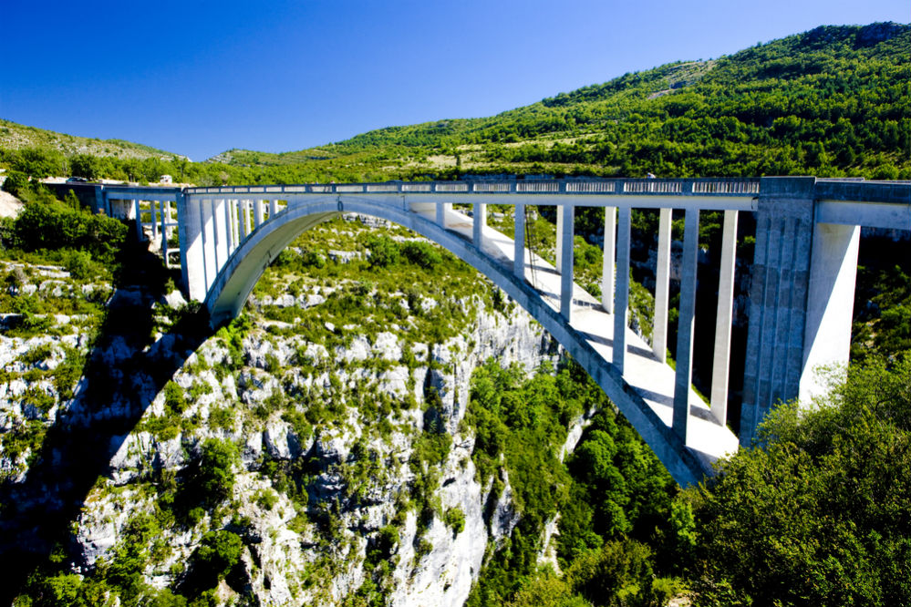
An excellent panorama opens from the observation deck near the bridge Artyubi (Pont de l’Artuby). This is an arched bridge 182 meters high, which is beautiful in itself. From the bridge you can jump with a tarzank for about 100 euros (the cost depends on the number of people in the assembled group). If you decide on this adventure, be sure to reserve the place in advance here. Jumps are performed from April to November on weekends, in July and August – also on Fridays. After the jump, you will be given a certificate that you have committed it.
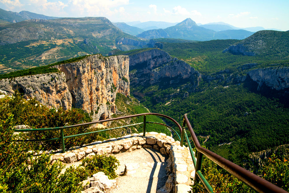
Literally two kilometers drive from the bridge, on the tallest edge of the gorge are located Meskla balconies (Balcons de la Mescla, GPS coordinates: 43.739760, 6.381795). This place is considered the best sightseeing point with breathtaking views of the running in the gorge River Verdon.
On the way from Balconies of Meskly On the west, on the road D71, you will find another cool observation deck, its GPS coordinates: 43.767565, 6.274359.
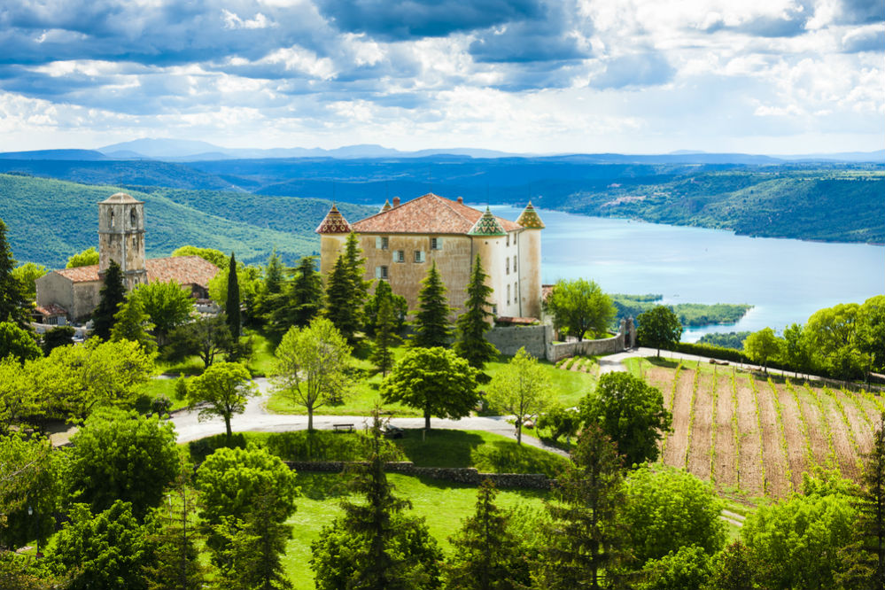
Following our route, after half an hour you will find yourself in the egina. Aegina (Aiguines) is a typical Provensal village, small, but very authentic. Perhaps the most interesting attraction here is the castle of the beginning of the 17th century (though it is private and closed to visits). In the immediate vicinity of the castle is the Church of St. John and the Mother of God (église de saint-jean et notre-dame),
Which has a courtyard with a beautiful view of the lake and mountains.
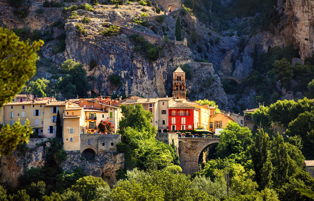
The next mandatory stop is a very elegant and cozy village Mutier-Sent-Marieknown mainly due to the production of faience products. Here’s what to do here:
1. Climb to the chapel Notre Dame de Beauvoir, located on the rock.
2. Consider the star suspended above the village on the cable between two rocks (below it may seem small, but its weight is 400 kg).
3. Try lavender ice cream.
4. Buy a product from a local faience in one of the many shops. Here you can also visit the Fayance Museum, in which ancient samples have been exhibited since the 17th century.
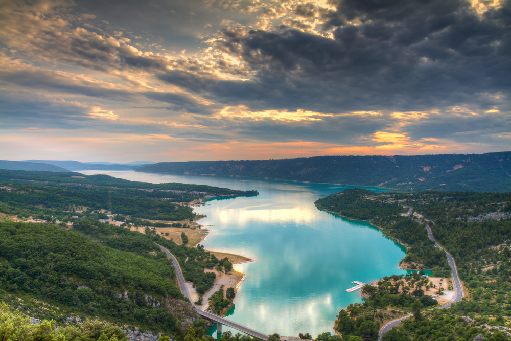
From Mutier-Sent-Mariego to Lake Saint-Kroi-Du-Verdon. This lake is one of the largest in France. It has an artificial origin and is a blocked by a dam of Verdon in the gorge of the same name. The water here is azure color, and limestone cliffs covered with coniferous vegetation rise around the perimeter.
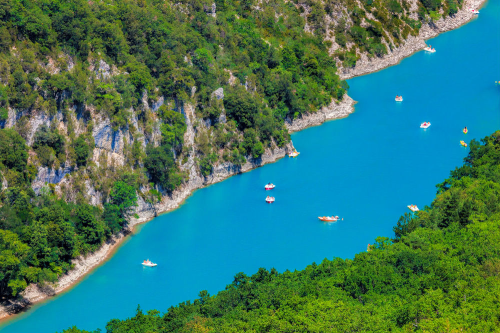
On the western bank of the lake, in the town of the same name Saint-Kroi-Du-Verdon By car, you can drive up almost to the water itself and the sandy beach (GPS coordinates: 43.757822, 6.152775). There you can also take a catamaran for 15 euros to ride a lake. You will have the opportunity to swim in the gorge itself, explore numerous grottoes, admire small waterfalls, and also land on one of the small “wild” beaches.
In itself Saint-Kroi-Du-Verton There are several good restaurants – a good place for lunch with a beautiful view and acquaintance with the kitchen of Provence (parking coordinates: 43.758890, 6.149977).
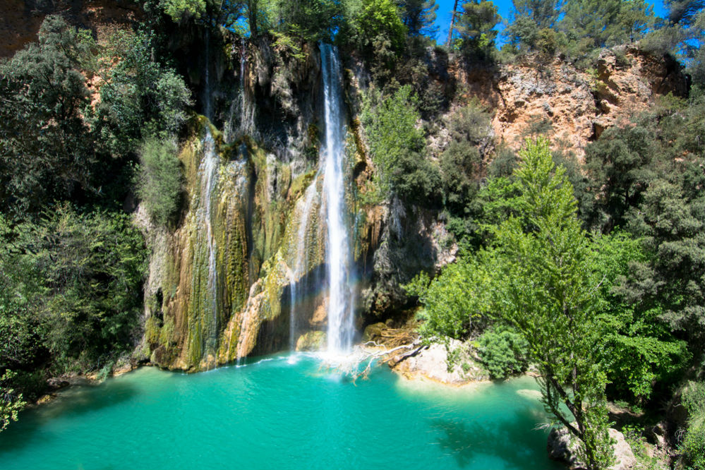
The last point of the route will be Silland Waterfall (Les Cascades de Sillans). The waterfall is located on the BRESK River, its height is 44 meters. We advise not only to look at the waterfall from the road, but also go down to the river (GPS coordinates: 43.568015, 6.179136),
To see cool thresholds. This is worth doing if the weather also allows your shoes: the descent is quite steep and slippery.
You can finish the route in Marseille or in Nice (road to both cities from Silland waterfall will take no more than 2 hours on the A8 highway). You can also get to the old city Russian (2 hours) and stop there at night, and the next day go further to the west to continue to study the upper Provence.
When looking for a hotel on OneTwotrip, use a card as a filter, so you can easily find a hotel next to you.