One of the recognizable symbols of America is the faces of the four presidents carved on the slope of Mount Rashmore (Rushmore). The mountain is located right in the center of the country, near the city of Rapid City, South Dakota (on the map). From another center of attraction of tourists, Chicago, route No. 90 leads to it. The distance of one and a half thousand kilometers can be overcome in a day, in 14 hours. But it is much more interesting to stretch pleasure, spend the night along the road, and see provincial America. And if you choose this option, then the places that can be visited along the way are described below, not strongly deviating from the main route.
Rent a car
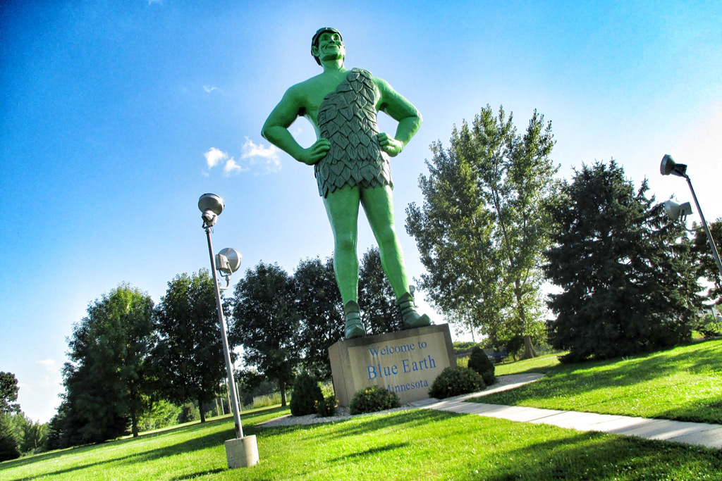
700 kilometers from you can stop drinking coffee in a town with an unusual name Blue Earth (Blue Earth),
Minnesota (on the map). After coffee with Muffin, you can take a picture with a giant statue of a cheerful green giant (Jolly Green Giant). Near it there is a small souvenir shop, where he bought something that has entered, he bought something or not, they ask to sign in the book of visitors.

Photo: Roadpickle.com
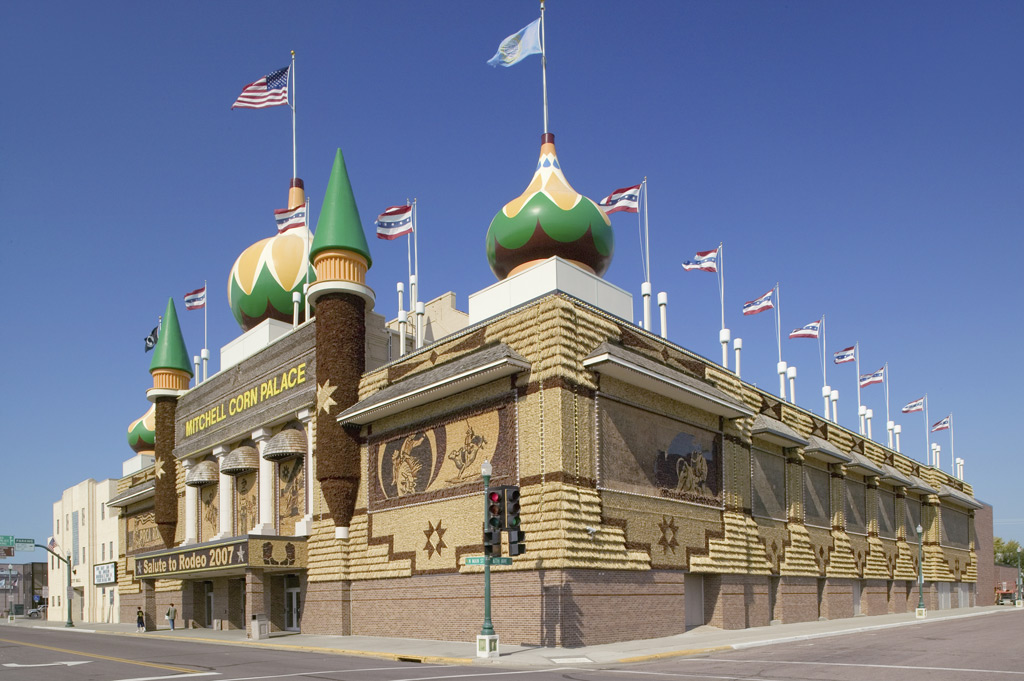
After another 320 kilometers along the highway there will be a city of Mitchell (Mitchell),
South Dakota. A typical town of Midwest, lost among corn fields. Locals decided to use this and created the only corn palace in the world. In fact, this is something between the sports hall and the palace of culture with the arena and sedentary places in the stands. The basis of the palace of the most ordinary building materials, the highlight is in the cladding: all the walls are both outside and inside, are laid out of the cobs of corn. And not just laid out, but represent plots on various topics. This is Christianity – Christmas, the baptism of the Lord (let’s not forget that people in the Middle West are very religious) – and the plots of the times of the development of these lands, and different others. Every year, the “exposition” changes, since corn material is short -lived. All this pleasure costs local authorities not cheap – more than a million dollars a year, but, apparently, the flow of tourists pays for these expenses. The entrance is free, inside a small souvenir bazaar.

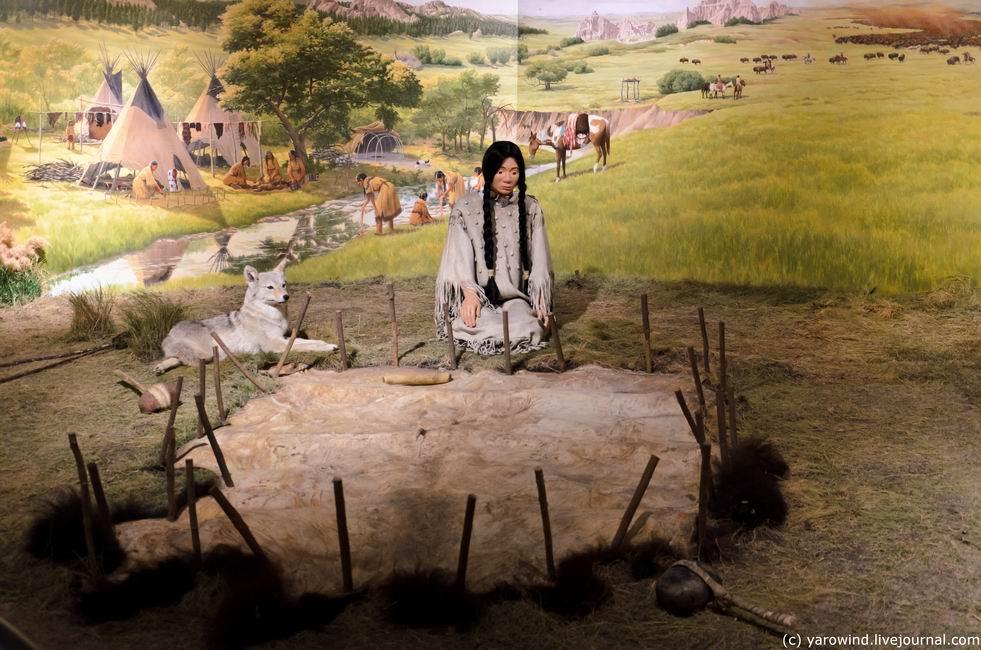
After 110 kilometers, you can see a pointer to the town of Chemberlain. It is located near the reservation of the Lacot Indians. Here you can call in the Indian Museum, located on the territory of the Catholic School of St. Joseph. The entrance is free. You can also look at the Missouri River – the largest tributary of the Mississippi, on the shore of which Chemberlen stands. For Americans, this is the same inseparable couple as Russian Ob and Irtysh.

If you go on Saturday, then, having moved Missouri along the bridge, about five kilometers from Chamberlain, turn right at the town of Oakom (Oacoma). There is a great flea market with funny prices (on the map).
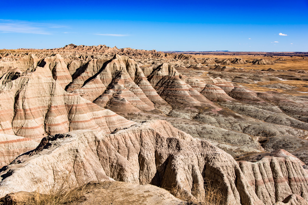
Another 200 kilometers and you will reach the territory of the Badland National Park – bad lands. Even from the highway you will see how unimportant they are. From a geological point of view, the area is a zone of clay erosion hills that formed about five thousand years ago. Since the rocks here are very unstable to rains and winds, the terrain is constantly changing, and, returning here literally a couple of years, you will see that the landscapes have changed. If there is not enough time, then just look from the car window, but we persistently recommend that you spend at least a couple of hours on this place. To do this, turn from Hyveya to the highway 240. Entrance to the National Park is paid, something about $ 20 per car (check the price on the official website of the park). There you will be given a card where you are marked with viewing sites, where you can park the car and make excellent species photos, as well as hiking paths. There is something like a camp site on the territory, so you can spend the night and explore everything in detail. The western part of the park is free, but the landscapes are simpler here.
Do not forget to look and feed meadow dogs – animals like marchings, which are a great many. They are almost not afraid of people.

Another hundred kilometers, and you are at the final point-Rapid City. In the vicinity of the city there is not only a rock with the presidents, but also an impressive memorial of a frantic horse (Crazy Horse), an impressive
An old wooden fort from colonization, mountain lakes, caves, National Park Caster (Custer) with herds of bison grazing by the road, an impressive rock cliff and much more. You will not be bored.
On the trip, pay for the purchases of the OneTwotrip loyalty card, and up to 10% of the order on OneTwotrip, as well as up to 2% of any purchases paid by the card, will return to your account.
Author: Vladislav Yarovind
You may be interesting:
Road Trip: Seven useful tips on how to rent a car on a trip
What to see in Chicago (free)
The natural beauty of the United States

